
Dracut Postal Coverage
Only one standard postal ZIP was located for Dracut proper. The neighboring code often appears in regional searches, but the official material identifies it with Dunstable rather than Dracut delivery. The distinction matters: a nearby code is not evidence that a parcel, household, voter, or municipal record belongs to Dracut. Use an exact address for postal confirmation and retain the municipality supplied by the assessor or GIS when the address is near a town line.
| ZIP | Areas covered | Post office | Local reading |
|---|---|---|---|
| 01826 | Dracut, Massachusetts, the town's standard postal area | USPS Dracut facility, 54 Broadway Road, Dracut MA 01826-9998 | Primary Dracut ZIP. Its Census ZCTA is statistical, not a legal delivery or parcel boundary. |
| 01827 | Dunstable, Massachusetts | USPS Dunstable facility, 170 Pleasant Street | Neighboring ZIP, not verified as a Dracut delivery ZIP. |
No second Dracut ZIP, PO-box-only ZIP, unique-institution ZIP, split year, or current ZIP-outside-town address list was located in the official sources. That is a research limit, not a reason to add a code from a commercial list.
Dracut's Main Postal ZIP
01826 is the standard postal ZIP for Dracut. The facility listing gives a physical postal reference, while the ZIP itself describes mail delivery geography. It does not establish town jurisdiction, ownership, school district, precinct, census count, or a list of everyone living in the area. For a disputed address, preserve both the postal result and the municipality shown by local land records rather than replacing one with the other.
The official USPS Dracut location identifies the facility at 54 Broadway Road.
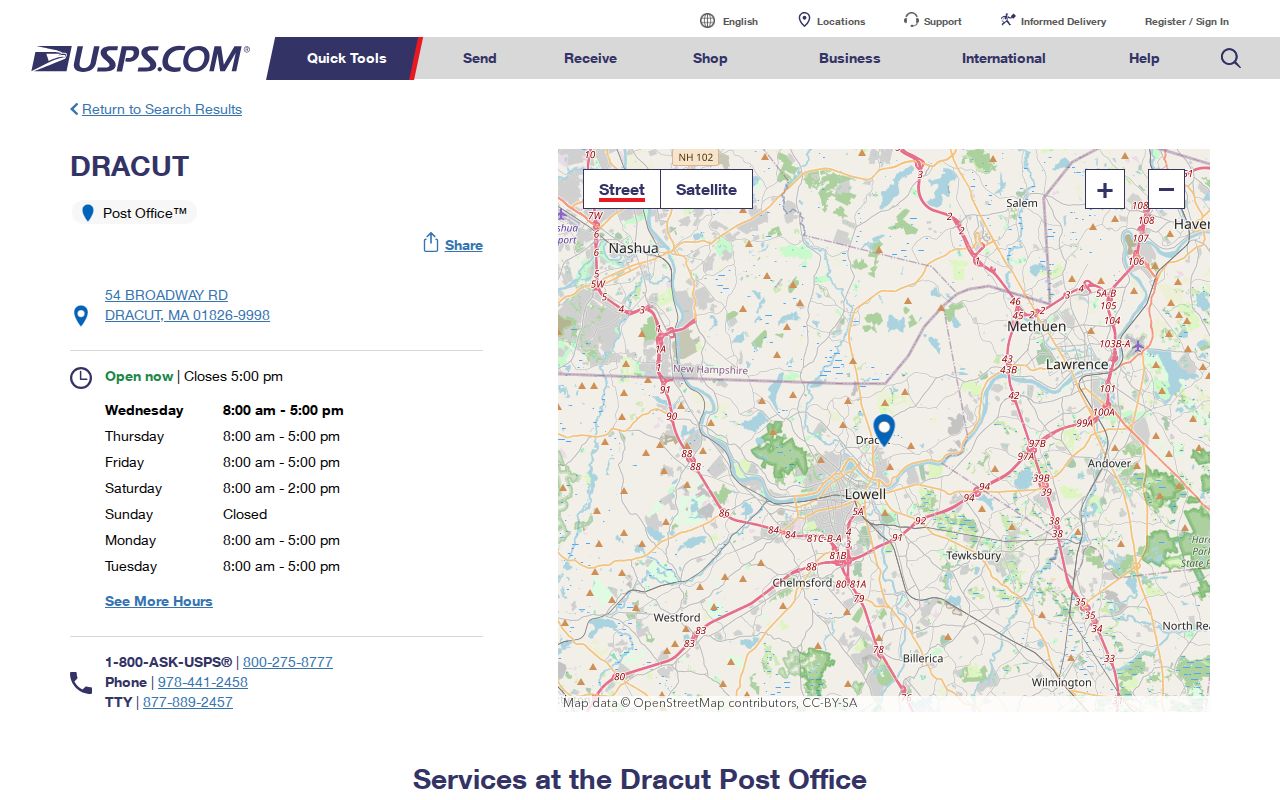
The location evidence confirms the postal facility and ZIP used for Dracut mail, but an address-specific USPS lookup remains the correct check for a particular delivery point.
Verify a Dracut Postal ZIP
Use USPS before searching another source because it normalizes the mailing address actually in question. Keep the street number, directional word, suffix, apartment or unit, and city spelling from the returned result. Then compare the postal result with the assessor's situs address and the GIS parcel. A mismatch may reflect a mailing address, town boundary, historic label, or data-entry difference. It should not be silently treated as a new parcel or a new municipal ZIP.
Dracut is bordered by Lowell, Methuen, Tewksbury, Tyngsborough, and Pelham, New Hampshire. Postal and municipal geography can therefore be close without being identical. The official 2022 property maps and map sheets through 74 give parcel-map context, but the Town says those maps show relative positions and are not legal boundaries.
Boundary check. Two cemeteries maintained by Dracut use Lowell postal addresses. That local example separates the municipal custodian, the current postal city, and the historical Dracut connection.
Dracut Voter Lookup Fields
The state voter registration form is the only verified person-search portal here that visibly accepts a five-digit residential ZIP. It is not a ZIP roster or a browse tool. The form is designed for the individual voter to check registration status, and its acknowledgement states that intended use. A ZIP narrows a named, date-of-birth query; it does not return everyone in 01826.
| State voter field | Format | Why it matters |
|---|---|---|
| First Name | Text | Use the name as registered. |
| Last Name | Text | Pair it with the other required identity details. |
| Date of Birth | Month, day, and year dropdowns | Required person-specific field. |
| Residential ZIP | Five-digit text | Required identity field, not a ZIP-wide filter. |
| Acknowledgement | Checkbox | States that the form is intended for the individual voter to determine registration status. |
The Massachusetts Voter Registration Search displays the individual-use acknowledgement and the four identity inputs.
For a recent registration, the state instructions say an update can take two to three weeks. A prior ZIP can be relevant after a move, but the result still concerns a named individual, not a postal-area list.
Find Dracut Residents by ZIP
A ZIP can help organize the next record search, but no official Dracut portal was verified to return all residents or parcels by ZIP. The GIS prompt accepts Owner, Address, or ID. The Vision assessor page advertises name and address searching, but its dynamic controls did not expose a ZIP-wide filter. A careful process starts from an exact address or a named individual, not from an assumed directory of everyone in one postal area.
- Verify the specific mailing address with USPS and retain the returned ZIP alongside the full address.
- For a named individual checking registration status, use the Massachusetts form with first name, last name, date of birth, residential ZIP, and its acknowledgement.
- For a lawful local-list question, ask the Town Clerk for an existing annual street-list arrangement by street, precinct, or resident and ask about the applicable production charge.
- For land, enter the exact address in Dracut GIS, record the parcel ID, inspect the assessor context, and use the Registry for the legal title trail.
Once an exact address is known, the Dracut street directory provides the address-by-address sequence for parcels, deeds, permits, local lists, and historic directories. A ZIP is an organizing clue, not a replacement for that parcel-level review.
Dracut ZCTA Census Statistics
The Census 01826 ZCTA reported about 32,689 people in 2020. That figure describes a Census statistical geography, not a postal-delivery boundary. It is useful for broad context, but it is not a count of Dracut households, registered voters, assessed owners, parcels, or directory entries. Dracut's municipal population and the ZCTA total should remain separately labeled because the two geographies are not interchangeable.
The Census profile for 01826 labels the ZIP-based statistical geography.
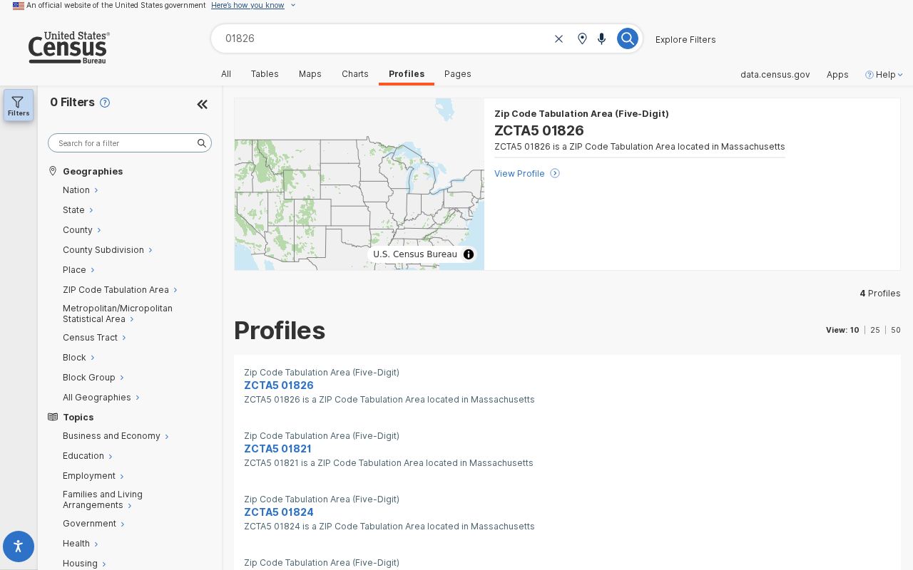
The profile is strongest for aggregate context. It cannot confirm postal delivery to a specific house or identify a resident at an address.
Dracut Postal Map Layers
Postal, electoral, statistical, and parcel geography perform separate jobs in Dracut. USPS determines mailing delivery for a particular address. The Town's December 2022 street and precinct map places streets in one of nine precincts. GIS and assessor records locate a parcel and its MBL. The Census ZCTA supplies aggregate statistics. There is no located official statewide ZIP-to-precinct crosswalk for every Dracut address.
Some streets cross precinct lines. The map index lists Myron Road in 4B and 5B, and Wagon Wheel Road in 4A and 4B. That does not split a ZIP, and a shared ZIP does not put every address in one precinct. Record the actual precinct from the Town map and the exact parcel from GIS when those distinctions matter.
Note: Use the postal service for delivery, the precinct map for voting geography, Census for totals, and GIS or the assessor for parcels.
Dracut Postal Boundaries
A postal city line is not a town boundary or deed description. The two Lowell-postal cemeteries demonstrate why a municipal record can carry an address outside the postal name a researcher expects. Historical material can be even less direct: pre-1960 correspondence may use a post office or village in place of a modern ZIP, while a deed's legal description can outlast the postal label. Keep the original text and date, then add a modern postal comparison only as a cross-reference.
- ZIP
- A postal delivery code used with an address. It does not prove a municipality, precinct, parcel boundary, or ownership.
- ZIP+4
- An added four-digit delivery detail used with the five-digit ZIP. The research did not locate a Dracut-wide ZIP+4 list.
- PO-box ZIP
- A ZIP assigned for post-office boxes rather than normal street delivery. No Dracut PO-box-only ZIP was located in the official sources.
- Unique ZIP
- A ZIP assigned to one large organization or institution. No unique Dracut ZIP was located.
- Carrier route
- A postal delivery grouping within an area. Any Dracut carrier-route exception needs exact-address USPS verification; no official town-wide exception list was located.
Dracut ZIP Research Order
Match the source to the question. A delivery question starts with USPS. A parcel question starts with the exact address in GIS and the assessor card, followed by a Registry document when legal title matters. A precinct question starts with the Town's street and precinct map, not with a ZIP. A population question belongs to the Census ZCTA profile, with its table year kept beside the number. A historical address may need a directory, deed description, or map comparison because a modern ZIP might not have existed when the source was created.
This order also prevents a mailing ZIP from being mistaken for a situs address. The assessor can show a separate mailing address for an owner, trust, estate, or tax-bill recipient. The GIS parcel and deed description remain the more suitable records for the property's location and legal identity. For a Dracut address near Lowell, retain each source's own label instead of forcing all records into one postal wording.
Dracut Postal Directory Limits
The available public sources do not support a complete roster of people in a ZIP. The state voter form is person-specific. The annual street list follows local access and confidentiality rules. GIS and Vision do not show a verified ZIP filter. Registry records document legal instruments, not a postal-area resident list. A result in any one source should retain the source's own purpose and date.
Protected voter records, Address Confidentiality Program participants, sealed records, nonpublic household details, and private utility or delivery customer data may not appear. Public information does not authorize unwanted contact or the disclosure of sensitive identifiers. Use only the narrow, lawful purpose supported by the record and verify important facts with the custodian.