
Dracut Previous Residents Sources
Past residents of a Dracut address leave different kinds of records. The current municipal parcel view fixes the starting address and MBL. The Middlesex North Registry carries the ownership trail. Historical directories and census schedules add the household layer, while tax rolls and maps can supply older context. Each source has a different date and purpose. Treat the rows below as an evidence ladder, not as interchangeable lists of people.
| Source | Years It Covers | Where Held | What It Shows |
|---|---|---|---|
| Assessment and GIS parcel records | Current, with dynamic updates | Town of Dracut Vision and GIS | Situs, MBL, assessed owner, map context |
| Recorded land name index | 1976-present | Middlesex North Registry / MassLandRecords | Grantor, grantee, recording, book or document reference |
| Registry books 1132 onward | January 1950-present | Middlesex North Registry | Deed images and legal descriptions |
| Registry books 1-1131 | 1855-December 1949 | Middlesex North Registry | Unindexed property images and deed pages |
| Directories and 1946 reverse index | 1898-1967 located runs | Dracut Historical Society | Historical address and household clues |
| Tax rolls | 1842-49 and 1861-93 | Dracut Historical Society | Taxpayer clues, requiring source checks |
Use the municipal parcel tools first because a street number can change form, while an MBL and legal description can hold a record trail together. The Town of Dracut assessment database information describes owner and address searching, and the Dracut GIS viewer visibly accepts Owner, Address, or ID. Neither turns an assessment name into proof that every person at the address lived there.
Freeze the Dracut Parcel First
Start a Dracut previous residents search by copying the current situs address and MBL from the GIS or assessor record. Keep the map number, street spelling, and any legal-description language found on the deed. The Vision database is the municipal valuation route. GIS is the map route, with a visible Owner, Address, or ID search. A situs address identifies the parcel location; a mailing address can identify an owner, trust, estate, corporation, or tax recipient elsewhere.
The distinction is essential. An owner on an assessment card, a deed grantee, a person who receives a tax bill, a directory occupant, a boarder, and a voter can have separate roles. Record the exact source label before connecting them. Dracut’s property map series also uses map numbers, making map number, MBL, street number, and legal description useful controls if an older deed uses a different road spelling. No citywide renumbering date was verified, so a changed number should be tested against deeds and maps rather than assumed.
Note: Retain the original address text even after normalizing it, because older indexes may file a directional word or road suffix differently.
Trace Dracut Previous Residents Through Deeds
The title trail starts at the parcel, not at a name alone. The Middlesex North MassLandRecords portal provides recorded-land, book, property, document, date, unindexed-property, pre-1855-book, and pre-1976 grantor/grantee routes. Locate the current deed or its book, page, or document reference. Then read the legal description, prior-deed reference, parties, date, plan references, and any easement language before stepping backward.
- Capture the present situs and MBL from the Dracut parcel record, then preserve its address spelling and map context.
- Find the current ownership deed by the property, book/page, or document reference and confirm that the legal description fits the parcel.
- Record the buyer and seller, the recording date, instrument type, prior reference, plan, and description clue.
- Search the prior owner in both party roles. The seller’s earlier purchase often appears with that person as grantee, while the grantor side records a conveyance out.
- Repeat the comparison of parcel, description, street name, plan, and neighboring parcels until the computerized index ends, then change methods for older books.
- Grantor
- The party who conveys an interest in a recorded document, commonly the seller in a deed.
- Grantee
- The party receiving that interest, commonly the buyer in a deed.
- Chain of title
- A documented sequence of conveyances connecting one ownership interest to an earlier one.
- Legal description
- The land description in the deed, often more stable than a street address when older records use different numbering or road forms.
The recorded-land search page shows the official search environment used for the name and property stages.
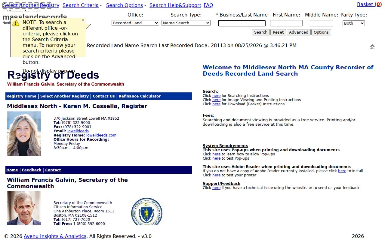
The index supports a reproducible title search when every result is tied back to the parcel and image rather than a similar surname alone.
Dracut Deed Index Search Fields
Use broad name searching first, then narrow by town, date, or document type after identifying a plausible party. The Registry instructions advise omitting a middle initial for the broadest starting result. The results display 20 rows with pagination. Advanced controls narrow by document type, town, or date, and images must be inspected before a result joins the chain.
| Office and Search Type | Dropdown controls that select the Registry office and search route. |
|---|---|
| Business or Last Name, First Name, Middle Name | Party-name fields. Omitting a middle initial broadens the search. |
| Party Type controls | Two controls for refining a party’s role in the record. |
| Document Types and Towns | Dropdown filters used after a broad result identifies likely records. |
| Recorded Date From and To | Date limits that can reduce a common-name result set. |
| Compressed and Like | Optional checkboxes visible in the recorded-land name search. |
The result schema includes an indexed party or business name, party role, document type, town, recorded date, book/page or document number, image link, and pagination. A name hit is only an index lead. The legal description and image are what connect it to the Dracut parcel.
1976 Dracut Deed Index Break
The computerized recorded-land name index begins in 1976. For earlier property history, the Registry’s pre-1976 grantor and grantee indexes are essential. Search the historical period and surname, move to the closest name on the returned index page, and inspect adjacent pages because the returned name is the first name on that page. A missing computer result before 1976 is an access boundary, not proof that a transfer did not occur.
There is a second trap inside the newer period. Deeds imported for 1976 through 1986 can carry document type “none.” A strict deed-only filter may hide them. Search the legal-name variants, keep the town and date in view, and then inspect the image. The Registry reports that online search, viewing, printing, and downloading were free at inspection, but it does not provide a result-set export.
For a certified remote copy, the Registry posts $5 for most documents or plans and $15 for mortgages. It asks searchers to call about documents over ten pages, and mail requests need a check and self-addressed stamped envelope. That mail route is for certified copies; it is different from the observed free online image access.
Walk Dracut Books 1 to 1131
Book search begins with book 1132 in January 1950. Books 1132 through 1590 display as single-page images, while book 1591 and later are multipage documents. Entering a book alone retrieves its pages, which is the recommended fallback if an exact page does not appear. This makes a book/page reference from a deed, tax record, or earlier index especially valuable.
Books 1 through 1131 cover 1855 through December 1949 as unindexed property images. They have no computerized name index. Walk the book and page carefully, copy the names and legal-description clues, and carry each prior reference into the next search. That manual work is the normal older-record method for a Dracut address, not a gap that can be solved with a modern name query.
Note: Mark each image with its book and page before moving on, because later pages can contain the only link to an earlier conveyance.
Pre-1855 Dracut Deed Pages
A useful scan check. Pre-1855 Middlesex North material consists of older documents copied in 1855 and separated by town. The searcher needs the town, book, and page. An apparent missing page may be a scan behavior instead: the selectable odd-page image can show the right side while the facing even page appears in the next odd-page image. Read the next odd image before deciding that the facing page is absent.
Early material should be treated as an older deed route, not a present-day address search. Compare the town reference, legal description, map context, and adjacent owners with the later chain. Dracut’s older records can be distributed among town, county, state, church, military, and family collections, so provenance matters more than a tidy narrative.
1946 Dracut Address Index Story
A rare historical trail. Polk’s 1946 Lowell City Directory includes a reverse Street/Address Index, giving a rare way to move from an old Dracut street and number to a historical occupant surname. Search the street guide first, preserve the abbreviated road form, carry the returned surname to the alphabetical section, and then compare the household line with an appropriate deed or census record. The index is evidence of occupancy at the directory’s time, not a title record.
The historical shelf runs from 1898 through selected 1967 volumes, with nonannual gaps. The full collection and its titles are described on the Dracut City Directory page. Use it to locate an edition, then return to the address chain with the year and page in the research notes. A directory date and a census date can conflict because directories were canvassed before publication while census enumeration occurred on a fixed date.
Pair Dracut Previous Residents With Census
Title only answers who held a recorded interest. The household layer needs a separate comparison. A directory can show an address, occupation, spouse notation, or business; a census can show household composition; a tax roll can identify a taxpayer. Keep the source date and role in the notes. Do not turn a directory occupant into an owner, or a taxpayer into the only person at the parcel.
The evidence flow is simple: current address and MBL, then deed and legal description, then the address directory result, then the closest census schedule, followed by any tax roll, permit, cemetery, vital, or probate source that fits the question. If the sources disagree, record the disagreement and its dates. Federal census schedules for 1900, 1910, 1920, 1930, 1940, and 1950 provide the documented pairing points, subject to the federal 72-year release rule for newer schedules.
For a public archival fallback, the Massachusetts Archives catalog permits text, collection, result-count, and between-date searching across digital materials. It can support a name or date lead, but it does not replace the parcel-based Registry chain.
The Massachusetts Archives search interface shows the catalog route used when a directory or deed supplies a name and era.
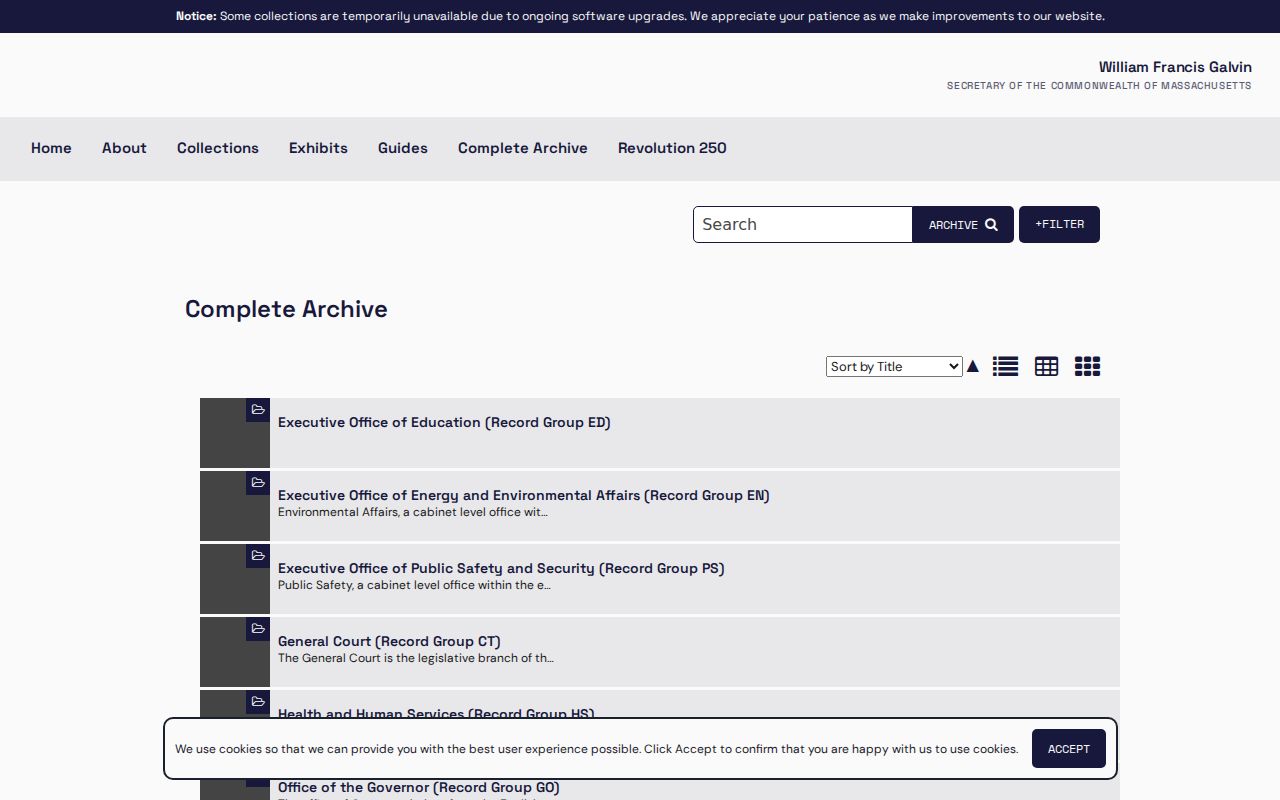
Archive filters can narrow a historical lead by collection and date while the Dracut parcel record remains the anchor for the address trail.
Dracut Previous Residents Context
The Historical Society holds tax rolls for 1842-49 and 1861-93, town reports from about 1832 to the present, maps, development plans, and genealogy files. The library’s Preservation Plan, local books, town reports, and the 1946 reverse directory are useful house-history companions. Ask the library for a collection referral or shelf check, while recognizing its stated boundary on legal and microform research. Cite the exact title, year, and page instead of treating a directory line as a deed.
A strong log includes street or situs, MBL or map number, deed book/page or document number, recorded date, grantor, grantee, instrument type, prior reference, plan, legal-description clue, and confidence. A trust, estate, corporation, or tax recipient is a research event with its own role. A gap should remain a gap until another record directly connects it.