
Dracut Neighbor Source Table
A block record is not a household roster. Dracut neighbors can be researched by comparing a mapped parcel, an assessment relationship, a legal title record, a lawful local voter-list request, and published civic or historical sources. The source must stay labeled because an adjoining parcel, a registered voter, an old directory occupant, and a committee participant are not interchangeable descriptions of who lives near an address.
| Source | What It Shows About a Block | Access |
|---|---|---|
| Dracut GIS | Parcel polygons, map IDs, address and owner search, and mapped adjacency | Public viewer; exact select and buffer controls were not verified |
| Vision assessor | Current owner, situs, mailing context, and assessment information when displayed | Public dynamic record |
| Middlesex North Registry | Title transfers, legal descriptions, plans, and adjoining parcel context | Free online inspection; older research may require books |
| Dracut street list and precinct map | Lawfully available voter and street geography, subject to statutory limits | Town Clerk request and public map |
| Agenda Center and historical collections | Published civic participation, minutes, directories, maps, and historical context | Public search or library and Historical Society inquiry |
Owner and occupant are separate roles. A mailing address may belong to an owner, trust, estate, or tax recipient elsewhere. A parcel can also have more than one structure or interest. Treat the table as an evidence ladder, not a way to infer every person in a household.
Mapping Dracut Neighbor Parcels
The public Dracut GIS is the starting point for an immediate-block question. Its search prompt accepts Owner, Address, or ID. Search the target address, identify its parcel polygon and map ID, then zoom to the road frontage and inspect the surrounding parcel shapes. The research did not verify a current buffer, identify, or click-control label, so the method should describe the observed parcels without claiming an unobserved one-click feature.
- Address: enter the known address in GIS and retain the displayed parcel ID or MBL when available.
- GIS parcel: confirm the target polygon and its road frontage before deciding which shapes touch it.
- Adjacent parcels: inspect neighboring polygons and record only the public map ID, address, or owner context shown on the card.
- Vision: check the current assessment record for owner, situs, and mailing context.
- Registry: verify a boundary or title question through a deed or plan’s legal description.
This sequence distinguishes a parcel relationship from a same-street or same-precinct relationship. For a complete named-street chain rather than the immediate block, use the address records in the Dracut street directory.
Note: The GIS says the Town does not warrant accuracy, timeliness, or completeness, so a map edge is not a legal boundary finding.
Checking Dracut Neighbor Ownership
The Dracut Vision assessment database is the next check after map geometry. The Town describes the database as covering location, size, value, ownership, improvements, and demolitions. The dynamic research capture did not expose every field or filter, so use the card only for labels actually displayed. In particular, a situs address is where the property is located, while a mailing address is where the owner or notice may be reached.
When the relationship needs legal confirmation, open the Middlesex North Registry record. Recorded Land Name, Property, Book, and Plans searches can lead to an instrument’s named parties, date, book or page, legal description, prior reference, easements, or plan. The Registry is better for who conveyed land; the GIS is better for what mapped parcel touches another. A deed party is not automatically a current neighbor or occupant.
Dracut Neighbor Voter Limits
Massachusetts has two different voter routes. The state registration search is individual and requires first name, last name, date of birth, five-digit residential ZIP, and an acknowledgement. It can return registration or pre-registration, active or inactive status, polling location, and officials. It is never a way to browse everyone on a block.
For a local record, the Town Clerk is the custodian for the annual street list and a request can ask for an existing arrangement by street, precinct, or smallest voting subdivision under M.G.L. c. 51. Dracut’s 2022 street and precinct map has nine precincts. A lawful list may contain public fields such as name, address, party, date of birth, and active or inactive status, but confidential voters, protected classes, phone and email, some minor records, and other protected information stay out. A list also does not guarantee that every adult or household member appears.
Dracut Civic Records Context
The Dracut Agenda Center is a searchable source for public meeting material by category, keyword, and dates. It can provide civic context through boards and committees, including the Council on Aging, Agricultural Commission, Cultural Council, Recreation Commission, Historical Society, Veteran’s Park Committee, and Open Space Committee. Other named public community channels include the Dracut Lions Club, Dracut Food Pantry, and Greater Lowell Chamber of Commerce.
The Agenda Center’s published categories and meeting records are shown below.
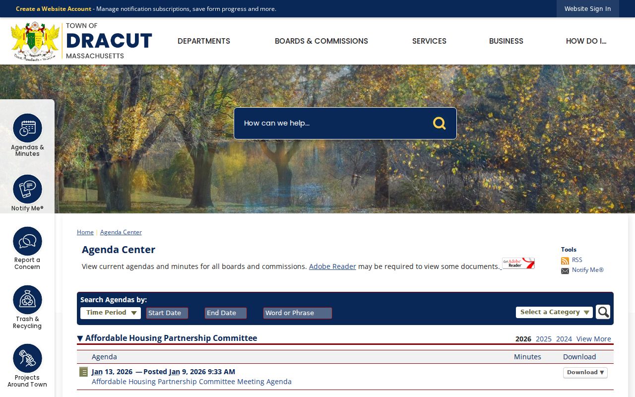
Minutes and agendas can identify a dated public role or discussion. They do not create a private membership directory. No authoritative neighborhood-association, HOA, block-watch, congregation, or private community roster was located for Dracut. The Town’s committee application is not a roster to republish.
Dracut Cemetery Neighbor History
For historical context, Dracut’s Cemetery Division manages lot sales, deed transfers, foundations, and burials for Bailey, Richardson, Varnum, New Boston, Hildreth Street, Oakland, and Hamblett cemeteries. The Cemetery Division is the official route for municipal cemetery administration.
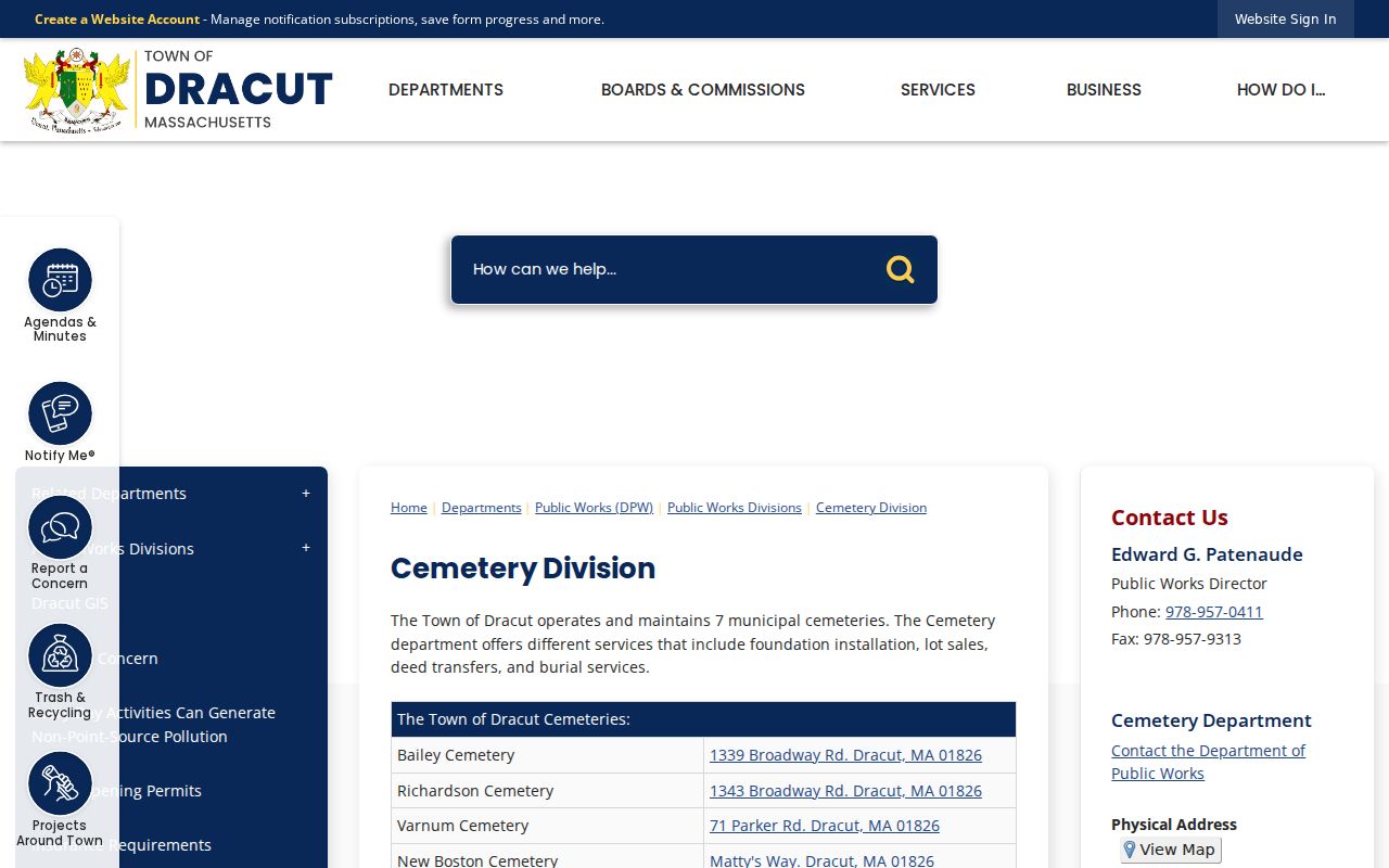
The seven municipal cemeteries give the block record a local historical layer, not evidence of present residency. Two town-maintained cemeteries use Lowell postal locations, a reminder that municipal boundaries, postal labels, and historical connections can differ.
The Chronicle Dracut cemetery search exposes seven public municipal datasets for an interment query.
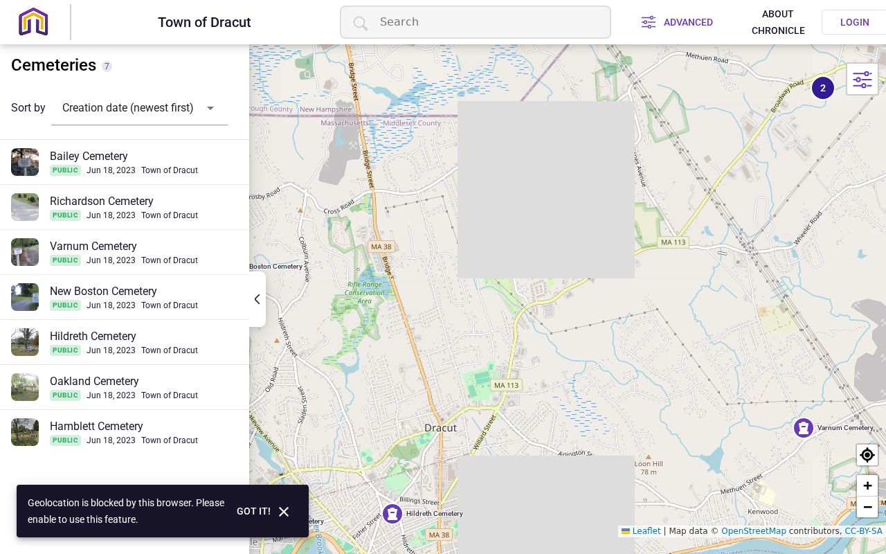
A result can be compared with cemetery-office records, probate, a death certificate when eligible, a newspaper notice, or a historical directory. It should not be treated as proof that the person lived at a nearby modern address.
Dracut Neighbor Evidence Compared
Official records and commercial compiled tools do different work. A compiled result may combine old addresses and names, but it should not replace an office-held source or be treated as verified fact. Compare each claim against a source that identifies its date, custodian, record role, and access limit.
| Official evidence | Commercial compiled tools | Best use |
|---|---|---|
| GIS parcel and Vision assessment card | May merge names and address histories without a visible source trail | Locate the parcel, then verify owner and situs with town records |
| Registry deed or plan | May omit legal descriptions, party roles, or older book records | Confirm conveyance and boundary context |
| Town list or public civic document | May not preserve confidentiality limits or update dates | Use only within the custodian’s lawful access rules |
Dracut Block Relationships
“Adjacent parcel,” “same street segment,” and “same precinct” are three separate Dracut relationships. A corner lot can touch two roads, a rear parcel can receive mail on another road, and a historical number may not match the current number. The property map shows relative parcel positions but is not a legal survey. The precinct map helps with voting geography, yet it does not replace a deed boundary or a GIS parcel shape.
The Dracut Library and Historical Society provide older directories, maps, tax rolls, and newspapers for past block research. Ask for a collection referral or shelf inquiry, then verify a historical directory occupant with the publication date, parcel, deed, or vital and cemetery record that answers the question.
Limits on Dracut Neighbor Lookup
The Massachusetts Public Records Law permits access subject to exemptions, not a complete view of private household life. Private utility, delivery, and customer records; RMV addresses governed by federal DPPA rules; protected voter information; Address Confidentiality Program addresses; sealed court materials; and nonpublic household details stay outside a neighbor lookup. A public result can describe a parcel, a legal title party, a historical occupant, an interment, or a published civic participant without proving that everyone connected to the name lives nearby.
The Massachusetts Address Confidentiality Program, M.G.L. c. 9A and 950 CMR 130, uses a substitute address and mail-forwarding mechanism for eligible participants. If a record is withheld or appears redacted, ask the original custodian about the governing exemption or an available redacted version. Do not infer protected information from related records.
Lawful use. Use Dracut neighbor records for personal, lawful research, shared-boundary questions, family history, or civic understanding. Do not use any source to watch, stalk, harass, intimidate, or harm another person.